UN
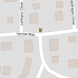
80 Yarrow Way
£ 383,000
Description
We don't have a Description for this property.
- Bedrooms
- 5
- Bathrooms
- 0


Leaflet © OpenStreetMap contributors
The heatmap indicates the level of crime in the area. The color of the heatmap indicates the crime severity and recency.
Metrics Year-on-Year
- Average area value
- 318,564.00 £Decreased by 14.91 %
- Average area rental value
- 5,698.00 £/moIncreased by 371.30 %
- Est rental Yield
- 21.46 %Increased by 453.09 %
- Crime Rate
- 5.00 %Unchanged by 0.00 %
from 374,400.00 £
from 1,209.00 £/mo
from 3.88 %
from 5.00 %
Nearby Schools
| Name | Type | Ofsted | Distance |
|---|---|---|---|
| Sovereign And Strawberry Meadow Children'S Centre | Children's Centre | 0.89 KM | |
| Brookfield Community School | Community School | Good | 1.03 KM |
| Locks Heath Junior School | Community School | Good | 1.24 KM |
| Sarisbury Infant School | Community School | Outstanding | 1.25 KM |
| Hook-With-Warsash Church Of England Academy | Academy Converter | Good | 1.29 KM |
Images
Nearby Streets
| Name | Average Price | Average Sqft | Distance |
|---|---|---|---|
| Highfields | £ 775,000 | 0 | 0.00 KM |
| Greenaway Lane | £ 685,000 | 0 | 0.00 KM |
| Dibles Road (East) | £ 491,667 | 0 | 0.00 KM |
| Sorrel Close | £ 0 | 0 | 0.00 KM |
| Seaford Road | £ 325,000 | 0 | 0.00 KM |
Nearby Transport
| Name | NLC | TLC | Distance |
|---|---|---|---|
| Swanwick | 5920 | SNW | 3.01 KM |
| Bursledon | 5927 | BUO | 3.73 KM |
| Hamble | 5947 | HME | 5.13 KM |
| Netley | 5911 | NTL | 6.59 KM |
| Botley | 5894 | BOE | 7.25 KM |
Nearby Listings
| Address | Price | Type | Score | Distance |
|---|---|---|---|---|
| Yarrow Way, Locks Heath, Southampton | £ 275,000 | BUY | 7 / 10 | 0.05 KM |
| Knottgrass Road, Locks Heath | £ 295,000 | BUY | Unknown | 0.09 KM |
| Knotgrass Road, Locks Heath | £ 285,000 | BUY | 5 / 10 | 0.09 KM |
| Campion Close, Warsash, Southampton | £ 380,000 | BUY | 7 / 10 | 0.11 KM |
| Campion Close, Warsash, Southampton | £ 520,000 | BUY | 6 / 10 | 0.12 KM |
Nearby Properties
| Address | Price | Distance |
|---|---|---|
| 56 Yarrow Way | £ 63,500 | 0.00 KM |
| 36 Yarrow Way | £ 383,000 | 0.00 KM |
| 40 Yarrow Way | £ 139,000 | 0.00 KM |
| 84 Yarrow Way | £ 184,000 | 0.00 KM |
| 48 Yarrow Way | £ 290,000 | 0.00 KM |